National Weather Service issues tropical storm and flood watches for Marion County
This morning the National Weather Service issued a tropical storm watch and flood warning for Marion County.
A Tropical Storm Watch means that tropical storm conditions with winds between 39 mph and 73 mph are possible within the watch area, generally within 48 hours.
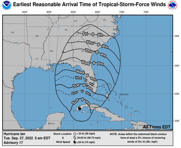
Hurricane Ian is expected to approach the west coast of Florida within the hurricane warning area on Wednesday and Wednesday night as a major hurricane.
Hurricane-force winds extend outward up to 35 miles from the center and tropical-storm-force winds extend outward up to 115 miles.
According 5 a.m. update from the National Weather Service, the hurricane’s maximum sustained winds are near 125 mph with higher gusts. Ian is currently a category 3 hurricane on the Saffir-Simpson Hurricane Wind Scale. Strengthening is expected later this morning after Ian emerges over the southeastern Gulf of Mexico.
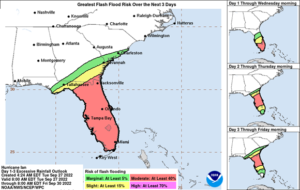
The flood watch issued to Marion County means conditions are favorable for flooding, but it does not mean flooding will occur, only that it is possible.
The Marion County Board of County Commissioners issued a local state of emergency in response to the threat of Hurricane Ian on Monday, Sept. 27.
The action activates the Marion County Comprehensive Emergency Management Plan, with the Division of Emergency Management under the Marion County Sheriff’s Office (MCSO) coordinating the overall county response to the emergency.
Nine sandbag operations are operating from 8 a.m. to 7 p.m. today according to a post by the MCSO. Those locations are:
Dunnellon City Complex, 11808 N Ohio St., Dunnellon
Wrigley Field, 405 County Road East 316, Citra
East Marion Sports Complex, 14445 NE 14th St. Road, Silver Springs
Belleview Sports Complex, 6501 SE 107th St., Belleview
Jervey Gantt Park, 2200 SE 36th Ave., Ocala
Tuscawilla Park (Reilly Arts Center), 800 NE Sanchez Ave., Ocala
Hampton Center, 1501 W Silver Springs Blvd., Ocala, FL
Martel Recycling Center, 296 SW 67th Ave., Ocala
Marion Oaks, 294 Marion Oaks Lane, Ocala, (behind the Community Center)
The MCSO noted that sandbag locations are self-serve and officials are asking that citizens limit their consumption to 10 bags a vehicle.
Marion County Public Schools announced this afternoon that they will close district-wide Wednesday and Thursday. Tuesday will be a regular school day; however, West Port High School will switch to virtual learning so the school can transition into a special needs shelter. All extra-curricular activities district-wide Tuesday are cancelled.
West Port High, 3733 SW 80th Ave., will open today at 5 p.m. as a special needs shelter.
The following schools will open Wednesday at 12 p.m. as additional shelters:
Belleview Middle, 10500 SE 36th Ave.
Dunnellon High, 10055 SW 180th Ave. Road
Fort McCoy School, 16160 NE CR 315
Hammett Bowen Jr. Elementary, 4397 SW 95th St.
North Marion Middle, 2085 W. County Road 329
Vanguard High (pet friendly; 7 NW 28th St.
For more information about sheltering, call the Marion County Citizens Information Hotline at 352-369-7500.
Citizens can go to www.marionso.com or visit the Marion County Sheriff’s Office Facebook page for updates.
In addition, Emergency Management officials are encouraging all Marion County citizens to sign up for the emergency notification system, Alert Marion. Sign up for text message alerts, emails, and phone calls for severe weather at www.alertmarion.com.
Support community journalism
The first goal of the Ocala Gazette is to deliver trustworthy local journalism so corruption, misinformation and abuse are not hidden from the public or unchallenged.