Marion remains under tropical storm warning and flood watch
National Weather Service’s 5 a.m. Ian update for Marion County
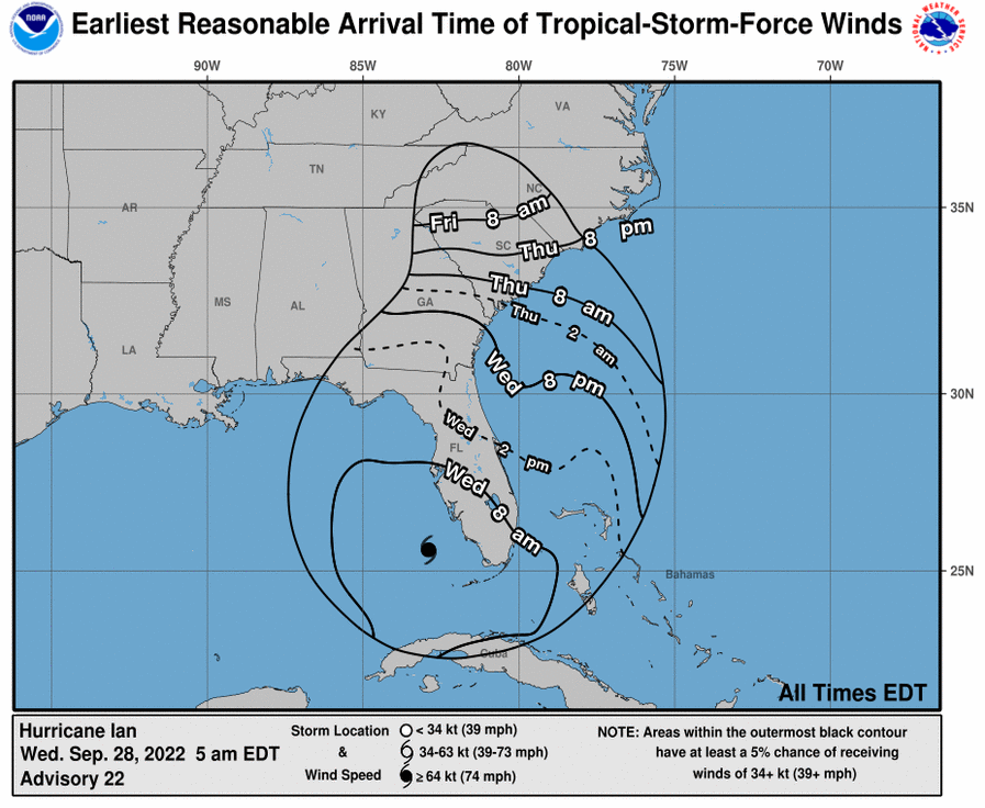
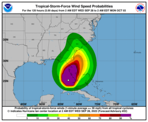
Major Hurricane Ian, located near 25.6 north, 82.9 west at 5 AM EDT Wednesday morning,
is expected to move north northeast today while
decreasing in forward speed. A turn to the north is expected Thursday.
On this track, Ian is forecast to move toward southwest Florida and make landfall
on the southwest Florida coast this afternoon. Ian has
strengthened to a category 4 hurricane with maximum winds currently near 140 mph with
higher gusts.
A tropical storm warning and a storm surge warning remain in effect for the entire
northeast Florida coast and the entire St. Johns River
basin.
A tropical storm warning is in effect for Marion County.
The start of tropical storm winds likely are to begin tonight and early Thursday
morning across north central and northeast Florida, and
midday Thursday over parts of southeast Georgia.
Increasing rain chances are expected through the day from south to north, with
more rain and rain squalls and possibly embedded thunderstorms occurring tonight through Friday.
Heavy rainfall with significant to extensive flash flooding is expected across parts of
northeast FL. A Flood Watch is in effect for for much of northeast Florida and portions
of southeast Georgia.
There is a concern for isolated tornadoes across parts of northeast and north
central Florida from this evening through at least Thursday evening.
Support community journalism
The first goal of the Ocala Gazette is to deliver trustworthy local journalism so corruption, misinformation and abuse are not hidden from the public or unchallenged.