Marion remains under a tropical storm warning and flood watch
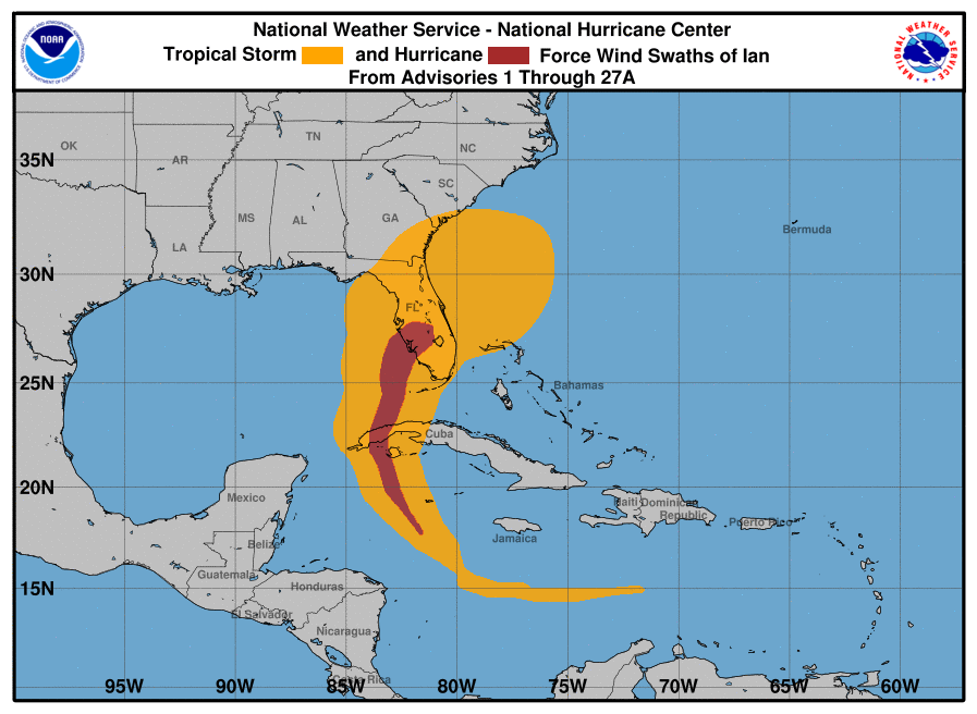
This graphic shows how the size of the storm has changed, and the areas potentially affected so far by sustained winds of tropical storm force (in orange) and hurricane force (in red). The display is based on the wind radii contained in the set of Forecast/Advisories indicated at the top of the figure. Users are reminded that the Forecast/Advisory wind radii represent the maximum possible extent of a given wind speed within particular quadrants around the tropical cyclone. As a result, not all locations falling within the orange or red swaths will have experienced sustained tropical storm or hurricane force winds, respectively.
National Weather Service 8 a.m. overview of Tropical Storm Ian:
At 800 AM EDT (1200 UTC), the center of Tropical Storm Ian was
located near latitude 28.5 North, longitude 80.7 West.  Ian is
moving toward the northeast near 8 mph (13 km/h).  A turn toward the
north-northeast is expected later today, followed by a turn toward
the north and north-northwest with an increase in forward speed
Friday and Friday night.  On the forecast track, the center of Ian
is expected to move off the east-central coast of Florida soon and
then approach the coast of South Carolina on Friday.  The
center will move farther inland across the Carolinas Friday night
and Saturday.

Maximum sustained winds remain near 65 mph (100 km/h) with higher
gusts.  Some re-intensification is forecast, and Ian could be near
hurricane strength when it approaches the coast of South Carolina
on Friday.  Weakening is expected Friday night and Saturday after
Ian moves inland.

Tropical-storm-force winds extend outward up to 415 miles (665 km)
from the center.  Daytona Beach International Airport recently
reported a sustained wind of 60 mph (97 km/h) and a gust to 70 mph
(113 km/h).

The estimated minimum central pressure is 987 mb (29.15 inches)
based on surface observations.

Marion County remains under a tropical storm warning and flood watch.

Marion County Sheriff's office is encouraging everyone to stay off
the roads while crews assess damage.
Support community journalism
The first goal of the Ocala Gazette is to deliver trustworthy local journalism so corruption, misinformation and abuse are not hidden from the public or unchallenged.