Hurricane Idalia makes landfall near Keaton Beach as Category 3
Update for 7:45 a.m. on Wednesday, Aug. 30
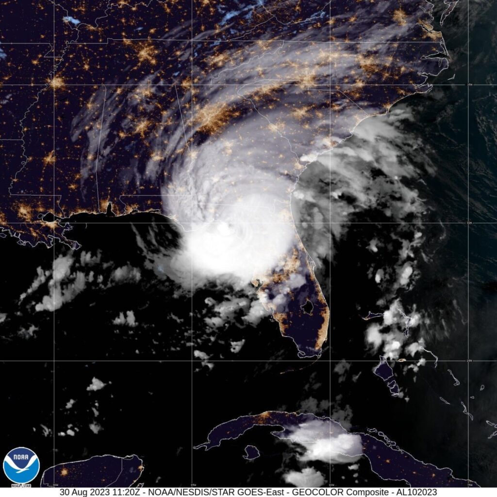
[Courtesy of the National Hurricane Center]
The eye of Hurricane Idalia made landfall around 7:45 a.m. Wednesday near Keaton Beach in the Big Bend of Florida, according to the National Hurricane Center.
A tornado warning was issued for Marion County at 6:54 a.m. after a rotation was spotted on the radar. A tornado watch has been extended until 3 p.m. The county will be under flood watch until further notice.
Western Marion County remains under hurricane warning. Central and eastern Marion remains under tropical storm warning, according to the National Weather Service.
As of 7:48 a.m., about 2,430 people under Ocala Electric Utility are currently affected by power outages. Duke Energy reports about 935 people, SECO Energy reports about 152, Clay Electric Coop reports about 1,264 and the Central Florida Electric Cooperative reports about 100 people experiencing power outages Wednesday morning.
Western and central Marion are forecast for wind speeds of 20 to 30 mph with gusts of up to 50 mph, eastern Marion to have similar speeds but with lower gusts of up to 45 mph, according to NWS.
Western and central Marion are forecast for 2 to 4 inches of rain. Eastern Marion is forecast for 1 to 3 inches of rain, according to NWS.
Tropical storm conditions will still be possible in the region throughout the day, subsiding in the evening for a chance of showers and slight wind.
Support community journalism
The first goal of the Ocala Gazette is to deliver trustworthy local journalism so corruption, misinformation and abuse are not hidden from the public or unchallenged.