Alternative Corridor North A
Editors’ Note: This summary is one of four routes. To read more about the other routes, click here.
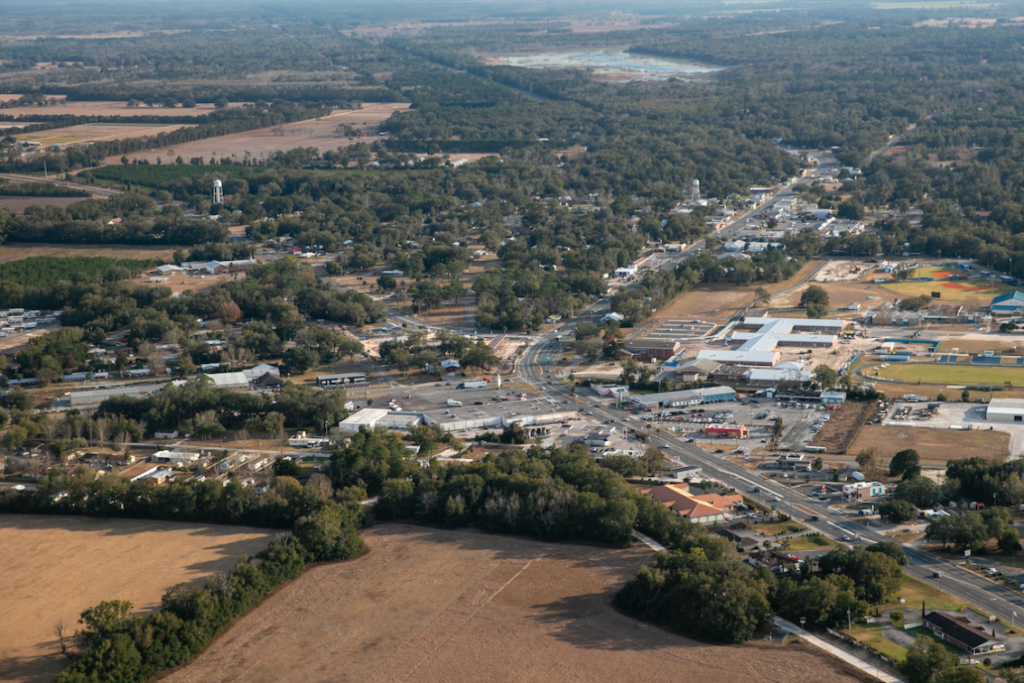
Agriculture in Levy County near Cheifland. The Florida Department of Transportation is planning a turnpike extension with one of the proposed routes coming close to this resource. Wednesday February 2, 2022. [Alan Youngblood/Special to Ocala Gazette]
Of all the routes, this one is almost double the length of the other routes proposed.
Social Impact—Degree of Effect 3, Moderate
The report indicated that the proposed route will need additional parcels for the proposed roadway expansion and improvements. Partial acquisition of land, homes, business, and other community features may affect the quality of life.
The Environmental Screening Tool (EST) Sociocultural Data Report (SDR) was used for demographic data within the route boundaries.
“The SDR identified a total population of 1,822 of which approximately 29 percent are minorities. Approximately 27 percent are persons over the age of 64. There are 752 households within Alternative Corridor North-A of which approximately 19 percent fall below the poverty level. The median household income is $40,455. Less than one percent of the population speaks English not well or not at all,” the report stated.
US Environmental Protection Agency (USEPA) assigned coded social impact as moderate and pointed out that FDOT had “not identified the degree of relocations upon the proposed corridor alternative.”
Amanetta Somerville of the USEPA wrote “The EPA encourages evaluating and discussing noise impacts and their effects upon local residences, schools, and communities in a future environmental document.”
“The impacts upon the community resulting from relocations and the potential limitation of ease of local businesses’ access to residents due to the proposed corridor alternative will further determine the degree of effect.”
Economic Impact—Degree of Effect 1, Enhanced
The report also points to the enhanced roadway network connectivity and its improved freight movement as well as connection to rural communities to transportation corridors and employment centers. The added connectivity will also enhance the goal of increasing tourism.
While Marion and Sumter Counties enjoy access via I-75 and Florida’s Turnpike, Levy County lacks direct connections and limited access highways. The Alternative Corridor North-A would support connections between rural areas and employment centers in urban areas.
Land Use Changes—Degree of Effect 3, Moderate
There are multiple land use issues that would arise from construction of the North-A extension.
The proposed route crosses the Southwest Florida Water Management District as well as the Suwannee River Water Management District.
The Alternative Corridor North-A is outside of the Marion County Farmland Preservation Area, but does traverse through Buddy Hiers Farms, located in Dunnellon, Marion County. The Hiers Farms are protected under the Rural and Family Lands Protection Program.
The Environmental Screening Tool (EST) and Geographic Information System (GIS) analysis did identify “farmlands of local importance” within this route.
Aesthetic Impact—Degree of Effect 2, Minimal
There are four state managed agricultural areas that are traversed by the proposed North-A route; Fowlers Bluff Conservation Area, Gum Slough Conservation Easement, Halpata Tastanaki Preserve, and the Cross Florida Greenway. In addition to these four areas, two proposed trail opportunities could be impacted: the Pruitt Gap Trail and Chiefland to Dunnellon Trail.
The Pruitt Gap Trail has been programmed and funded, while the Chiefland to Dunnellon Trail is currently unfunded.
Historical and Archaeological Sites Impacted—Degree of Effect 3, Moderate
The report indicated that three historic sites, two historic cemeteries, 23 archaeological/historic sites and seven linear resource groups would be impacted by this route.
Of the three historic structures, one is potentially eligible for listing on the National Register of Historic Places (NRHP) and the other two have not been evaluated by the State Historic Preservation Office (SHPO).
The Stringfellow Family Cemetery and Oak Grove Cemetery have not been evaluated by the SHPO.
Of the 23 archaeological/historic sites, two are eligible for NRHP listing, 12 are ineligible, and nine have not been evaluated.
Of the seven resource groups, two are eligible for NRHP, three are ineligible, and two have insufficient information necessary to make a determination.
In addition, there are 167 structures within the route that will be over 50 years old by the year 2030.
Wetlands and Surface Waters—Degree of Effect 4, Substantial
The report indicates substantial impact on wetland and surface water areas that exist in the path of the proposed extension.
According to the report, there are roughly 2,409 acres of jurisdictional wetlands within the 500 ft. project buffer zone.
The Florida Department of Environmental Protection (FDEP), Southwest Florida Water Management District (SWFWMD), and the U.S. Environmental Protection Agency (USEPA) suggests that the impact of North-A on water resources in the path of construction to be substantial since intersects the Silver Springs, Suwannee and Rainbow Springs and Rainbow River Basin Management Action Plan areas, as well as the Levy County Forest/Sandhills Outstanding Florida Water (OFW) and the Withlacoochee River OFW.
FDEP commented in the report that increased stormwater runoff carrying pollutants from the increased impervious surface (roadway)may alter adjacent wetlands and surface waters.
FDEP also stated that every effort should be made to maximize treatment of stormwater runoff.
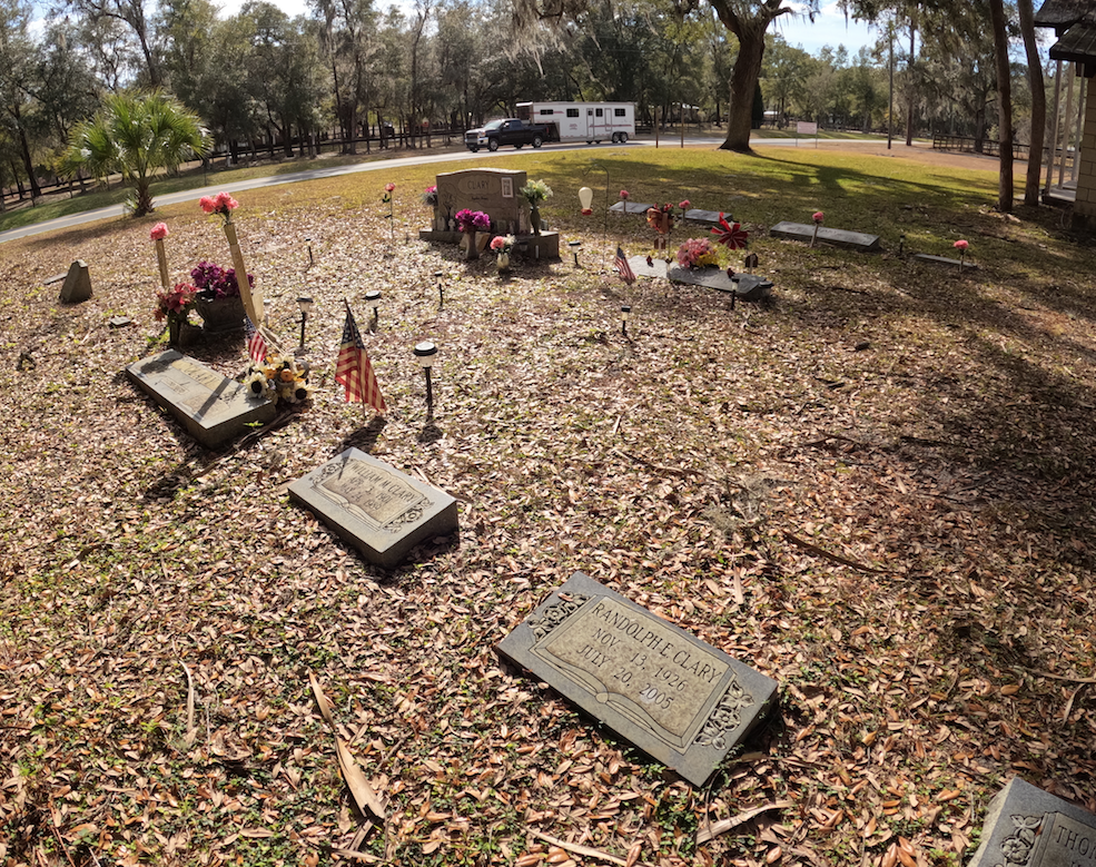
Grave sites are shown in the Church of Christ Cemetery in Morriston in Levy County, Fla. on Wednesday, Feb. 2. The proposed toll road Alternate Corridor North A route would bring the toll road very close to the Morriston Church of Christ and the Church of Christ Cemetery. [Bruce Ackerman/Ocala Gazette]
Protected Species and Habitat—Degree of Effect 3, Moderate
There are numerous animal species and habitats that could be affected by the North-A corridor construction and development.
The Florida Department of Agriculture and Consumer Services (FDACS), Florida Fish and Wildlife Conservation Commission (FWC), SWFWMD, and the U.S. Fish and Wildlife Service (USFWS) have all recommended a moderate degree of effect for the North-A proposal.
FDACS noted the presence of sandhill habitat within the state forests, yet the Critical Lands and Waters Identification Project (CLIP) found that North-A contains the least Priority 1 lands (3,985 acres, or 14.76% of total project area) as compared to the other corridor proposals.
This route is within the USFWS Consultation Area for the Florida scrub-jay, red-cockaded woodpecker, sand skink, and snail kite. The projected area is also within a Florida scrub-jay service area and Florida black bear range.
The FWC stated that habitat loss would occur with the construction of North-A, due in part to the opportunity for residential and commercial development, as well as water degradation from stormwater runoff.
FWC recommended measures to address wildlife and habitat impacts, including preparing a Natural Resources Evaluation (NRE), plant community mapping and multiple wildlife surveys, developing a plan to address all project effects to wildlife and habitat resources, as well as create alternate plans for habitat replacement.
Air Quality—Degree of Effect 2, Minimal
According to the USEPA, the proposed project area may temporarily degrade air quality during construction and recommended the use of diesel emission controls, cleaner fuel, and cleaner construction practices for on-road and off-road equipment used for transportation, soil movement, or other project activities.
As a result, the USEPA determined that the degree of effect would be minimal.
Contamination—Degree of Effect 4, Substantial
There are 16 storage tank contamination monitoring sites, one petroleum contamination site, six Resource Conservation and Recovery Act (RCRA) facilities, six hazardous waste facilities, and one solid waste facility within the proposed North-A route.
The FDEP commented that the Contamination Screening Evaluation should outline specific procedures that would be followed in the even that any drums, wastes, tanks or potentially contaminated soils are encountered during construction.
The concern of the USEPA is with the possibility of encountering subsurface hazardous wastes, that groundwater could be contaminated and degrade land use.
Opposition to the proposed North-A extension
The Levy County Board of County Commissioners, in a letter dated December 21, 2021, declared their position of “No Build” for any option of a Northern Turnpike Extension Corridor Route that may be proposed through Levy County, Florida.
The board indicated that it had received “a considerable amount of citizen input expressing the desire for a ‘No Build’ option for the Northern Turnpike Connector, due to concern over the disproportionate negative impacts on Levy County, its environmental assets, its agricultural assets, its rural neighborhoods, its ecotourism industry and its way of life.”
The letter, signed by Wilbur Dean, County Coordinator for the Levy County Board of County Commissioners, was also provided to Governor Ron DeSantis, Florida Senate President Wilton Simpson, and Honorable Chris Sprowls, Speaker.
Support community journalism
The first goal of the Ocala Gazette is to deliver trustworthy local journalism so corruption, misinformation and abuse are not hidden from the public or unchallenged.