Alternative Corridor South
The Alternative Corridor South starts from I-75 and the current Turnpike termination at Wildwood in Sumter County to a yet to be decided “logical terminus” in Citrus County, connecting with SR 41.
Editors’ Note: This summary is one of four routes. To read more about the other routes, click here.

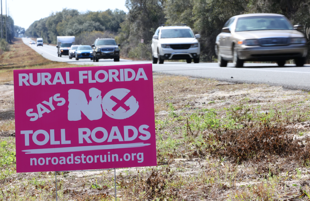
A “No Toll Roads” sign is shown as motorists drive on State Road 200 west of County Road 484 and west of Ocala, Fla. on Tuesday, Feb. 1. [Bruce Ackerman/Ocala Gazette]
Social—Degree of Effect—(3) Moderate
The Environmental Screening Tool (EST) Sociocultural Data Report (SDR) was used for demographic data within the route’s boundaries identified a total population of 7,762 of which approximately 11% are minorities. Approximately 31% are persons over the age of 64.
There are 3,328 households within the proposed corridor of which 20% fall below the poverty level. The median household income is $46,623—less than 1% of the population speaks English not well or not at all.
Inverness, Crystal River, Wildwood, Citrus Springs, Hernando and Pine Ridge are all cities that fall within 100 feet of the proposed corridor.
Mobile Home and RV Parks that fall within 100 feet include Marie Winship, Julia Way MHP, Croft Bay Village MHP, Old House Gallery MHP, Riverside Lodge RVP, Sandy Oaks RV Park, Thunderbird MH and Thousand Palms RV Resort.
Amanetta Somerville of the US Environmental Protection Agency (EPA) determined in the assessment that the proposed project alternative would potentially impact residences along the proposed corridor. The EPA cited noise impacts and their effects upon local residences, schools and communities.
Regarding resources, Somerville acknowledged in her assessment that the proposed project would need additional parcels for the proposed roadway extension and improvements—so any partial acquisitions of land, homes, businesses or any other community features may affect the quality of life of those impacted.
Economic—Degree of Effect—(1) Enhanced
From a job access perspective, the assessment determined that Sumter County is generally served well by I-75 and Florida’s Turnpike, while Citrus County generally lacks direct connections to limited access highways.
Corridor South route would support connections between the two counties and employment centers in urban areas.
Aesthetic Effects—Degree of Effect—(2) Minimal
This route traverses four managed areas: Flying Eagle Preserve, Half Moon Wildlife Management Area, Lake Panasoffkee and Withlacoochee State Trail, as well as the adjacent Ross Prairie State Forest and Crystal River Preserve State Park.
Cultural (Historic, Recreational and Protected Lands)—Degree of Effect—(3) Moderate
The study for this route, found 49 historic structures, four historic cemeteries, 62 archaeological or historic sites, six linear resource groups and one designed historic landscape. The report estimates that by 2030, there will be 536 structures within the proposed corridor over 50 years old.
This report indicates that this route traverses Central Ridge District Park, Citronelle Park, Hernando Park, Hernando Park Beach, Hernando Public Boat Ramp and Hernando Trailhead in Citrus County and Lake Panasoffkee Trailhead and Royal Community Park in Sumter County.
Florida Forever Board of Trustees (BOT) projects and state park/forest optimum boundaries were reviewed, said the assessment. The Florida Forever BOT Project Florida Springs Coastal Greenway is adjacent to the Alternative Corridor South, which falls within the state park/forest optimum boundary for expanding the Half Moon Wildlife Management Area.
FDEP commented that future environmental documentation should include an evaluation of the primary, secondary and cumulative impacts of roadways on state lands and recreation sites. The department also indicated their preference that a corridor picked does not bisect the Cross Florida Greenway.
Wetland and Surface Waters—Degree of Effect—(4) Substantial
Chris Stahl of FDEP and Amanetta Somerville (EPA) both expressed concerns about substantial adverse effects on water quality.
Zakia Williams of the US Fish and Wildlife Service, David Rydene of the National Marine Fisheries Service and Monte Ritter (SWFWMD) felt the degree of effect would be moderate.
The National Wetlands Inventor (NWI) identified palustrine, lacustrine and riverine wetlands on this route. The majority of which are located near the Withlacoochee River and the state managed areas of Flying Eagle Preserve, Half Moon Wildlife Management Area and Lake Panasoffkee.
The agencies noted that this route crosses numerous marsh and spring systems.
The mouth of the Withlacoochee River, Withlacoochee Bay and the Gulf of Mexico contain habitats used by federally managed fish species and their prey. There are concerns with potential runoff into marine habitats and impacts to the area’s hydrologic regime.
In Williams’ report, she outlined several species of concern in the area, to include the Florida scrub-jay, sand skink, wood stork and the eastern indigo snake.
Water Resources—Degree of Effect—(4) Substantial
The Alternative Corridor South intersects the Silver Springs, Chassahowitzka-Homosassa and Kings Bay Basin Management Action Plan areas, the Kings Bay Springs Priority Focus Area, and the Crystal River Outstanding Florida Springs (OFS).
In addition, the verified Impaired Waters within the proposed corridor include the Cross Florida Barge Canal (nutrients and dissolved oxygen) and the Withlacoochee River (nutrients). The majority of the corridor is within a recharge area of the Florida Aquifer.
FDEP commented that increased stormwater runoff carrying pollutants from the increased impervious surface may alter adjacent wetlands and surface waters including OFS (Gum Spring, Gum #1 Spring and Alligator Spring), and Outstanding Florida Waters (Crystal River and Withlacoochee River).
Natural resource impacts within and adjacent to the proposed road right-of-way will likely include alteration of the existing surface water hydrology and natural drainage patterns, and reduction in flood attenuation capacity of area creeks, ditches and sloughs.
Protected Species and Habitat—Degree of Effect—(3) Moderate
Alternative Corridor South contains various habitats, stated the assessment. It has the second-least percentage of Priority 1 lands (23.36%, 6,631 acres) compared to other alternatives, while also having the second-least habitat of all alternatives (31.74% Moderately High, 9,651 acres). No critical habitat is found within or near the alternative corridor area.
State and federally listed avian species potential occurring within Alternative Corridor South include eastern black rail, Florida scrub jay, least tern, red-cockaded woodpecker, burrowing owls, Florida sandhill cranes, snail kite, Southeastern American kestrels and wading birds. The corridor also contains a habitat for the bald eagle, located approximately 370 to 500 feet from the proposed corridor.
Rare and imperiled fish, including the ironcolor shiner, could be found within the watersheds. The alternative corridor also crosses the Withlacoochee River, which is used by the Florida manatee.
FWC stated that primary impacts from Alternative Corridor South include habitat loss, future habitat loss due to opportunity for residential and commercial development and water degradation from stormwater runoff.
Air Quality—Degree of Effect—(2) Minimal
The EPA commented that the proposed project may temporarily degrade air quality during construction, recommending the use of diesel emission controls, cleaner fuel and cleaner construction practices for on-road and off-road equipment used for transportation, soil movement or other project activities.
Contamination—Degree of Effect—(3) Moderate
Within the Alternative Corridor South, there are 31 storage tank contamination monitoring sites, five petroleum contamination monitoring sites, 10 hazardous waste facilities, 13 Resource Conservation and Recovery Act (RCRA) regulated facilities and five solid waste facilities.
Due to the number of contamination-related features within the area, and the potential for impacts to the alternative corridor areas from existing sources of sub-surface contamination to occur would warrant a Contamination Screening Evaluation Report (CSER) be conducted.
Support community journalism
The first goal of the Ocala Gazette is to deliver trustworthy local journalism so corruption, misinformation and abuse are not hidden from the public or unchallenged.