Latest update on Tropical Storm Idalia
4:57 p.m. on Monday, Aug. 28
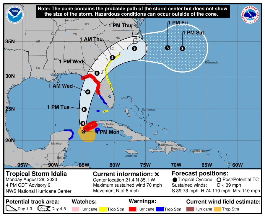
Tropical Storm Idalia is forecast to make landfall as a Category 3 hurricane in the Big Bend of the gulf coast Wednesday morning, according to the National Hurricane Center.
Western Marion County is now under a hurricane warning as of 4:57 p.m. on Monday as Tropical Storm Idalia nears hurricane strength, according to the National Hurricane Center.
Both hurricane and tropical storm conditions can be expected as early as Tuesday night, according to the National Weather Service.
Tropical Storm Idalia is forecast to make landfall as a Category 3 hurricane in the Big Bend of the Gulf Coast Wednesday morning, according to NHC.
Central Marion County remains under a hurricane watch and eastern Marion remains under a tropical storm watch until further notice, according to NHC.
Western Marion, including the Ocala Airport, Rainbow Lakes Estates, Dunnellon and Romeo can expect hurricane-force winds within the next 36 hours.
Wind speeds in this area are currently forecast at 20-30 m.p.h. with gusts of up to 55 m.p.h., but may reach an intensity of 74 to 110 m.p.h.
Peak rainfall in this area is expected to be about 3 to 6 inches but may be higher in some places.
Central Marion, including Ocala, Anthony, Burbank and Weirsdale, can expect lower than tropical storm force winds of 20 to 30 m.ph. with gusts of 74 to 110 m.p.h.
Peak rainfall in this area is expected to be about 2 to 4 inches but may be higher in some places.
Eastern Marion, including Lynne and Moss Bluff, can expect windspeeds of 15 to 25 m.p.h. with gusts of up to 40 m.p.h.
Peak rainfall in this area is also expected to be about 2 to 4 inches but may be higher in some places.
Support community journalism
The first goal of the Ocala Gazette is to deliver trustworthy local journalism so corruption, misinformation and abuse are not hidden from the public or unchallenged.