Fred expected to hit Florida as tropical storm

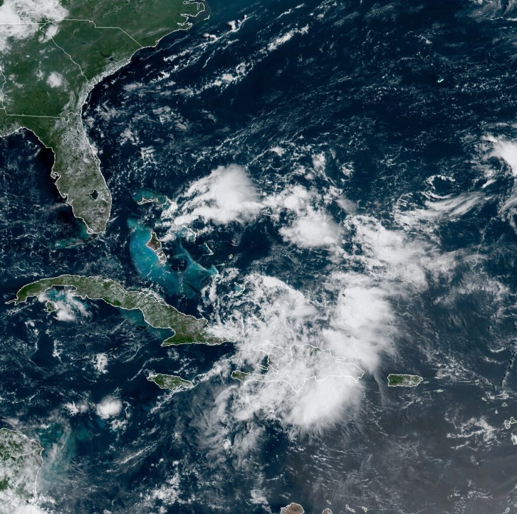
A satellite image provided by the National Oceanic and Atmospheric Administration (NOAA) shows Tropical Depression Fred in the Caribbean as it passes over the Dominican Republic at 10:40 am on Thursday. [NOAA/NESDIS/STAR GOES]

A satellite image provided by the National Oceanic and Atmospheric Administration (NOAA) shows Tropical Depression Fred in the Caribbean as it passes over the Dominican Republic at 10:40 am on Thursday. [NOAA/NESDIS/STAR GOES]
The main threat to the U.S. appeared to be heavy rains affecting Florida and parts of the Southeast starting on Friday, according to the U.S. National Hurricane Center.
It said 3 to 5 inches (7.5 to 12.5 centimeters) of rain were expected across the Florida Keys and southern peninsula by Monday, with isolated maximums of 8 inches (20 centimeters).
Already a tropical storm, it was weakened back to depression force by its spin over Haiti and the Dominican Republic, where it knocked out power to some 300,000 customers and caused flooding that forced officials to shut down part of the country’s aqueduct system.
Here are the 11 AM EDT Thursday, August 12 Key Messages for Tropical Depression #Fred. A tropical storm watch will likely be issued for portions of the Florida Keys and South Florida later this afternoon.https://t.co/rp4u3qEqMm pic.twitter.com/QS0JLgsknJ
— National Hurricane Center (@NHC_Atlantic) August 12, 2021
Heavy rains continued to pound Hispaniola, which the two nations share, on Thursday.
The Hurricane Center said the storm had maximum sustained winds of 35 mph (55 kph) Thursday morning while centered just north of Cuba’s eastern tip.
It was about 80 miles (125 kilometers) west of Great Inagua Island in the southernmost Bahamas and 230 miles (365 kilometers) east of Camaguey, Cuba.
It was heading west-northwest at 14 mph (22 kph).
Fred was expected to produce 3 to 5 inches (7.5 to 12.5 centimeters) o rain across the Dominican Republic and the western Bahamas, as well as 1 to 3 inches (2.5 to 7.5 centimeters) over Haiti, the Turks and Caicos, the eastern Bahamas, and Cuba.
Fred became the sixth named storm of the Atlantic hurricane season late Tuesday as it moved past the U.S. Virgin Islands and Puerto Rico.


