Alternative Corridor North B
Editors’ Note: This summary is one of four routes. To read more about the other routes, click here.
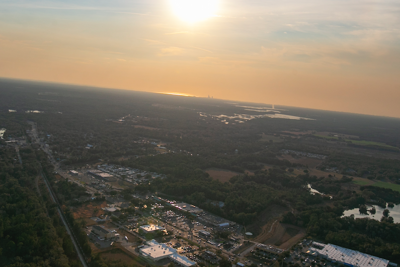
Businesses along US 41 in Dunnellon, Florida. The Florida Department of Transportation is planning a turnpike extension with one of the proposed routes coming close to this resource. Wednesday, Feb. 2. [Alan Youngblood/Special to Ocala Gazette]
The route is outside of the Marion County Farmland Preservation Area and initial analysis by FDOT “did not identify any farmlands of local importance.”
The route intersects the Silver Springs and Rainbow Springs and Rainbow River Basin Management Action Plan area and an area designated as a Spring Protection Zone by Marion County and the Rainbow Springs Priority Focus Area.
The majority of the corridor is within a recharge area of the Floridan Aquifer, and multiple agencies expressed concern about how run-off would impact water quality.
The area that the corridor lies falls in Levy, Marion and Sumter Counties. All three counties have indicated in their Future Land Use Maps (FLUM) support rural land uses.
The Levy County 2026 Future Land Use Map (FLUM), Marion County 2045 FLUM, and Sumter County 2035 FLUM indicate much of the area along the proposed corridor intends to continue to support primarily rural land uses, however portions along the corridor in Marion County reflect intent to increased residential.
Social– Degree of Effect 3-Moderate
Although the FTE intends to explore the social impact of this route in the future at greater length in another report, agency comments give a glimpse of what the impact of this route will have.
The Environmental Screening Tool (EST) Sociocultural Data Report (SDR) was used for demographic data within the route boundaries.
“The SDR identified a total population of 1,677 of which approximately 38 percent are minorities. Approximately 28 percent are persons over the age of 64. There are 657 households within Alternative Corridor North-B of which 14 percent fall below the poverty level. The median household income is $43,902. Less than one percent of the population speaks English not well or not at all,” the report stated.
US Environmental Protection Agency (USEPA) assigned coded social impact as moderate and pointed out that FDOT had “not identified the degree of relocations upon the proposed corridor alternative.”
Amanetta Somerville of the USEPA wrote “The EPA encourages evaluating and discussing noise impacts and their effects upon local residences, schools, and communities in a future environmental document.”
“The impacts upon the community resulting from relocations and the potential limitation of ease of local businesses’ access to residents due to the proposed corridor alternative will further determine the degree of effect.”
Further, the USEPA recommendation was for “meaningful public involvement, evaluation of the current local transportation system, and consideration of impacts to minority and low-income populations.”
Economic- Degree of Effect 1, Enhanced
FDOT the impact of this route should have a positive enhancement to the corridors economy by connecting “rural communities to transportation corridors and employment centers.”
“I-75 in this area is known to carry high volumes of freight truck traffic. High volumes of freight trucks are a positive economic indicator; thus, by supporting freight truck movements, these facilities affect local and regional economies,” the report read.
Based on local bed tax revenue reports, an FDOT estimated “1.15 million visitors came to the four-county Northern Turnpike Extension study area in 2019.”
FDOT acknowledged that improved transportation access to these tourist attractions is not sufficient to cause an in increase in tourism activity but that it could help support local economic development goals.
Aesthetic Effects- Degree of Effect 2, Minimal
None of the agencies commented on the aesthetics of the project for this route, but FDOT’s report noted that a “USDA Forest Service Florida National Scenic Trail, the Cross Florida Greenway, traverses” the route.
The route also intersects two state-owned managed areas, Ross Prairie State Forest and the Cross Florida Greenway, and the Cross Florida Greenway Trail.
The report stated that the route also “crossed by” two trails Pruitt Gap Trail and the Chiefland to Dunnellon Trail.
Cultural (Historic, recreational and protected lands)- – Degree of Effect 3, Moderate
The FDOT’s report indicates that there are 14 historic structures, 23 archaeological or historic sites, and five linear resource groups in the path of this route.
Of the 14 historic structures, one is ineligible for listing on the National Register of Historic Places (NRHP) and the other 13 have not been evaluated by the State Historic Preservation Office (SHPO).
Of the 23 archaeological or historic sites, one is eligible for NRHP listing, six are ineligible for NRHP listing, and 16 have not been evaluated by SHPO.
The report noted that by 2030, 71 structures within the route will have aged past 50 years.
Recreational and Protected Lands- Degree of Effect 4, Substantial
The Alternative Corridor North-B intersects two state-owned managed areas, Ross Prairie State Forest and the Cross Florida Greenway Trail System.
Ross Prairie State Forest is a 3,532-acre tract of public conservation land that was acquired in 1995 through the Conservation and Recreation Lands (CARL) program with funding from the Preservation 2000 Act. It is managed by the Florida Forest Service. Recreational opportunities on the forest include hiking, bird-watching, horseback riding, camping, and hunting. The main access point is from the Ross Prairie Trailhead located along SR 200 a mile south of County Road (CR) 484.
The trailhead is managed by the Florida Department of Environmental Protection (FDEP) Office of Greenways and Trails (OGT).
The Cross Florida Greenway is a 110-mile linear park that is more than a mile wide in places and hosts more than 300 miles of trails. It is managed by the FDEP.
Florida Forever Board of Trustees (BOT) noted projects and state park/forest optimum boundaries near the corridor including: Bear Hammock Florida Forever BOT Project, Longleaf Pine Ecosystem, South Goethe State Forest, Half Moon Wildlife Management Area optimum boundaries, Rainbow Springs State Park optimum boundaries, and Goethe State Forest State Park optimum boundaries.
The Florida Department of Environmental Protection (FDEP) commented that future environmental documentation should include an evaluation of the primary, secondary, and cumulative impacts of roadways on state lands and recreation sites.
The FDEP Division of Recreation and Parks report noted that “The Cross Florida Greenway would have the most significant direct impacts. Intersecting the Cross Florida Greenway would impact multiple federally and state listed plants and animal species including the globally imperiled longspurred mint (dicerandra cornutissima), which is considered endemic to the area. It would also impact the prescribed fire program, cultural resources from 1930s Depression era sea-level ship canal diggings, and visitors’ continuous trail experience.”
FDEP commented that of the routes, this route alternative has the least amount of wetland impacts at 1,326+ acres of jurisdictional wetlands within the 500-ft. project buffer zone.
FDEP recommend that the following be considered:
-Wetlands should not be displaced by the installation of stormwater conveyance and treatment swales; compensatory treatment in adjacent uplands is the preferred alternative. All stormwater treatment should be located in upland sites.
– After avoidance and minimization have been exhausted, mitigation must be proposed to offset the adverse impacts of the project to existing wetland functions and values. Significant attention is given to forested wetland systems, which are difficult to mitigate.
– The cumulative impacts of concurrent and future road improvement projects in the vicinity of the subject project should also be addressed.
FDEP Division of Recreation and Parks preferred “a corridor that does not bisect the Cross Florida Greenway.” Between the two northern alternative corridors, the FDEP recommend the longer 80-mile northern route that runs from Wildwood to Chiefland.
US Fish and Wildlife Service (USFWS) commented that the following species of concern may occur in the project area: Florida scrub jay, sand skink, wood stork, and eastern indigo snake. Moderate involvement with wildlife and habitat is expected.
National Marine Fisheries Service (NMFS) stated that it does not appear the project will directly impact NMFS trust resources; however, all Alternative Corridors will cross numerous marsh and spring systems. The mouth of the Withlacoochee River, Withlacoochee Bay, and the Gulf of Mexico contain habitats used by federally-managed fish species and their prey. NFMS stated concerns with potential runoff into marine habitats and impacts to the area’s hydrologic regime.
NMFS indicated it had no preference between the alternative corridor except that shorter alternative corridors were likely have less hydrologic impact.
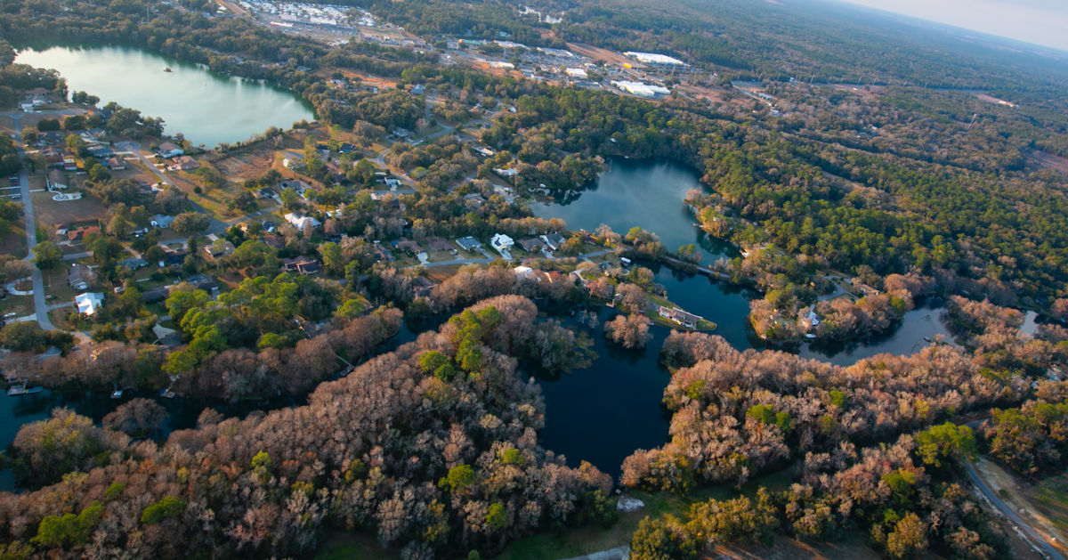
The Rainbow River in Dunnellon, Florida and Blue Cove. The Florida Department of Transportation is planning a turnpike extension with one of the proposed routes coming close to this resource. Wednesday, Feb. 2. [Alan Youngblood/Special to Ocala Gazette]
Protected Species and Habitat- Degree of Effect 3, Moderate
Florida Fish and Wildlife Conservation Commission (FWC) found when comparing of the alternative corridors by the various Critical Lands and Waters Identification Project (CLIP) priorities this route has the most Priority 1 lands (36.88%, 5,084 acres) compared to other alternative corridors.
FWC Integrated Wildlife Habitat Results ranked this route as having the most high-quality habitat of all alternative corridors (27.53% High, 4,069 acre).
This route is within the USFWS Consultation Area for the Florida scrub-jay, red-cockaded woodpecker, sand skink, and snail kite. It is also within a Florida scrub-jay service area and Florida black bear range.
However, the FWC found no critical habitat within or near the project area.
State- and federally- listed avian species potential occurring within this route include eastern black rail, Florida scrub jay, red-cockaded woodpecker, burrowing owls, Florida sandhill cranes, snail kite, Southeastern American kestrels, and wading birds.
The route does contain habitat for the bald eagle. The closest eagle nest (LV017) is located approximately 400 feet from the proposed Alternative Corridor North-B.
State- and federally- listed reptile and amphibian species potential occurring within the route include eastern indigo snake, gopher tortoise, pine snake, sand skink, short-tailed snake, and striped newt.
FWC stated that primary impacts from this route include habitat loss, future habitat loss due to opportunity for residential and commercial development, and water degradation from stormwater runoff.
This route could potentially have the least smoke shed impacts from prescribed burns.
Air Quality- Degree of Effect 2, Minimal
USEPA commented that the proposed project may temporarily degrade air quality during construction.
USEPA recommended use of diesel emission controls, cleaner fuel, and cleaner construction practices for on-road and off-road equipment used for transportation, soil movement, or other project activities.
Contamination- Degree of Effect 4-Substantial
Amanetta Somerville with the USEPA commented that “soils, groundwater, and surface waters have the potential to be affected adversely by contaminated sites. The contamination of groundwater can result in poor drinking water quality and loss of water supply.
Somerville indicated that Petroleum hydrocarbons are the primary focus of site and risk assessmentssince petroleum constituents that may negatively impact human health. Additionally, Somerville warned that contaminated groundwater could degrade land use if the wastes are not cleaned up, turning the property into a brownfield site.
Opposition to the proposed North-B extension
The City of Dunnellon’s mayor, William P. White, Mayor, wrote Representative Joe Harding in a letter dated January 18, 2022 that “the residents in your district that are impacted by this proposal are also soundly in opposition.”
The Dunnellon City Council declared their position of “no build” on the Northern Turnpike Extension by city council resolution 2021-26 and have asked Marion County Board of County Commissioners (MCBOCC) to join them in opposing the extension. Thus far, MCBOCC has taken a ‘wait and see what the study finds’ approach.
Support community journalism
The first goal of the Ocala Gazette is to deliver trustworthy local journalism so corruption, misinformation and abuse are not hidden from the public or unchallenged.