Alternative Corridor Central
Editors’ Note: This summary is one of four routes. To read more about the other routes, click here.
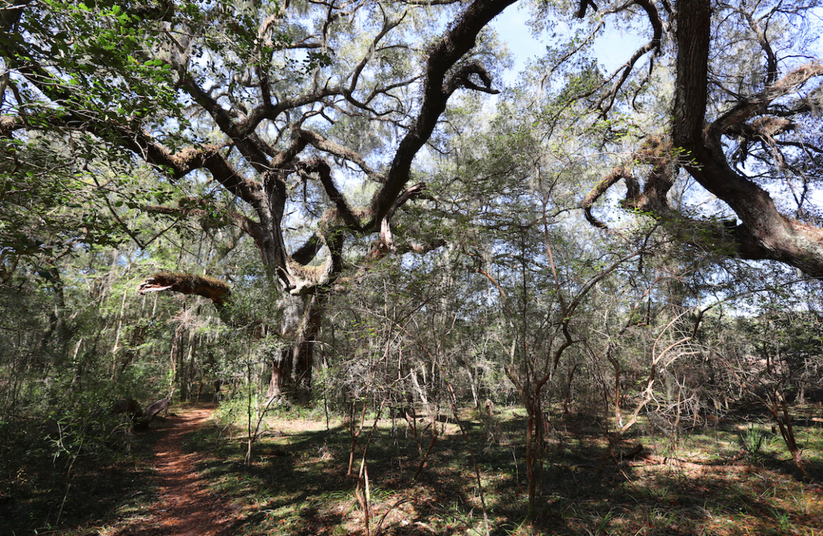
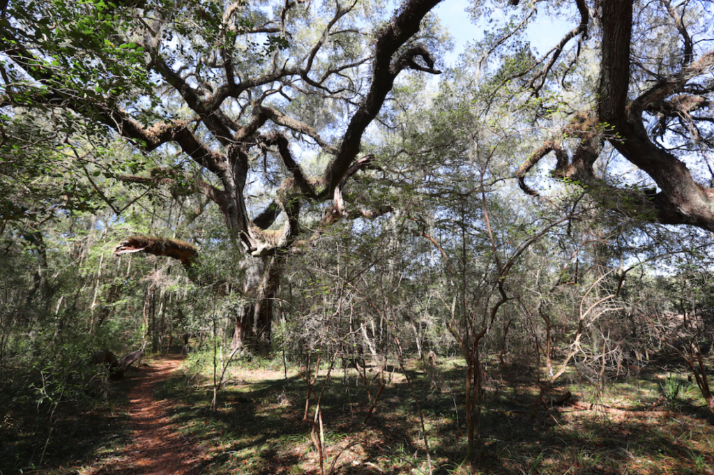
A large live oak winds its branches up and over the trail on the Marjorie Harris Carr Cross Florida Greenway Ross Prairie Trail, which is part of the Florida Trail, off State Road 200 west of Ocala, Fla. on Tuesday, Feb. 1. One of the proposed Northern Turnpike Extensions comes right through the Ross Prairie Trail and the Ross Prairie Forest. [Bruce Ackerman/Ocala Gazette]
Unlike the other three proposed routes, the Alternative Corridor Central has a much wider potential path. The route would be outside of any United States Department of Agricultural (USDA) Prime Farmlands as well as the Marion County Farmland Preservation Area. Further, Marion County’s Comprehensive Plan requires an amendment for development outside of the urban growth boundary,” which is where the road would fall.
Below is the project effects overview for Alternative #3 – Alternative Corridor Central.
Social – Degree of Effect – (3) Moderate
Amanetta Somerville, who reviewed the project for the Environmental Protection Agency (EPA) noted “The EPA encourages evaluating and discussing noise impacts and their effects on local businesses, schools, and communities in a future environmental document.”
FTE analyzed the 2015-2019 American Community Survey Five-Year Estimates and compared the three counties affected by the potential route with statewide averages and found that they have higher numbers of residents over the age of 64 as well as persons with disabilities.
Using the Environmental Screening Tool (EST) Sociocultural Data Report (SDR) to compile demographic data within the boundaries of the Alternative Corridor Central. The report stated “The SDR identified a total population of 10,281 of which 16 percent are minorities. Approximately 29 percent are persons are over the age of 64.”
The report stated there are 4,234 households within the boundaries of the proposed route, of which approximately 19 percent are below the poverty line. It indicated the median household income is $47,190, and less than 1 percent speaks English “not well or not at all.”
Economic – Degree of Effect – (1) Enhanced
The report stated, “Enhanced roadway network connectivity will improve freight movement, connect rural communities to transportation corridors and employment centers, and support the goal of increasing tourism…from a job access perspective, Marion and Sumter Counties are generally served well by I-75 in Florida Turnpike.”
The assessment goes on to state “The study area includes large rural areas with a low population density and few visitor attractions…while improved transportation access to these tourist attractions is not sufficient to cause an increase in tourism activity, it could help support local economic development goals.”
Aesthetic Effects – Degree of Effect – (2) Minimal
FTE observed there are no scenic highways within the area, “However A USDA Forest Service Florida National Scenic Trail, the Withlacoochee State Trail, traverses the Alternative Corridor Central.”
According to FTE, Marion County’s 2045 Future Land Use Map “Indicates that the area where the Alternative Corridor Central lies will continue to support rural land uses with an increase in residential uses,” and that “The proposed project aims to create an aesthetically pleasing corridor.”
As there will be a need for additional right-of-way to develop the proposed limited access corridor, FTE found that some properties within the area may be affected as a result of the proposed route, and “FTE will coordinate with the local communities and property owners as the project advances.”
Cultural (Historic, Recreational and Protected Lands) – Degree of Effect – (3) Moderate
The FTE noted there were “52 historic structures, two historic cemeteries, one historic bridge, 109 archaeological or historic sites, six linear resource groups, one designed historic landscape, and one mixed district within the proposed boundaries of the Alternative Corridor Central.”
Both Monte Ritter with the Southwest Florida Water Management District (SWFWMD) and Marcy Welch with the Florida Department of State (FLDOS) indicated a Cultural Resources Assessment Survey (CRAS) must first be conducted before both agencies can further assess the impacts.
FTE found that the proposed route crosses five managed areas: Gum Slough SWFWMD Conservation Easement, Halpata Tastanaki Preserve, Tsala Apopka/Two-Mile Prairie Connector, Withlacoochee State Forest, and Withlacoochee State Trail. Further, it would be adjacent to Ross Prairie State Forest, and Crystal River Preserve State Park.
Florida Department of Environmental Protection (FLDEP) Division of Recreation and Parks indicated they would prefer a corridor “That does not bisect the Cross Florida Greenway.”
The assessment also found the “Withlacoochee State Trail would be interrupted from having a continuous trail experience,” and that “Crystal River Preserve would be impacted by high traffic volumes and associated urban growth which may affect the wilderness characteristics and resource focus of the park.”
Wetlands and Surface Waters – Degree of Effect – (4) Substantial
Regarding wetlands and surface waters, according to Chris Stahl with the FLDEP noted that this route alternative had the “most amount of wetland impacts,” of the four proposed routes.
Additionally, he noted that forested wetlands are difficult to mitigate, and once contaminants reach wetlands, water chemistry changes can damage the ecosystem.
The proposed construction project will require an environmental resource permit(s) (ERP) from the SWFWMD and/or the FLDEP, and will be “required to eliminate or reduce the proposed wetland resource impacts of roadway construction to the greatest extent practicable.”
Somerville stated that the proposed route affected over 3,700 acres of wetlands, and its potential effects on habitats used by federally-managed fish species could be damaging. As a result of the proposed alternative’s significant and broad impacts, as well as the need for an ERP, “The EPA does not recommend this alternative.”
FTE observed in the assessment that design considerations such as pile bridging and median width reductions with safety limits should be utilized, and stated “Wetlands are important because they are a critical natural resource and serve several functions, including filtration and treatment of surface water runoff, store floodwaters, and provide erosion control. Stormwater runoff from roadways carries pollutants such as volatile organics, petroleum hydrocarbons, heavy metals, and pesticides/herbicides.”
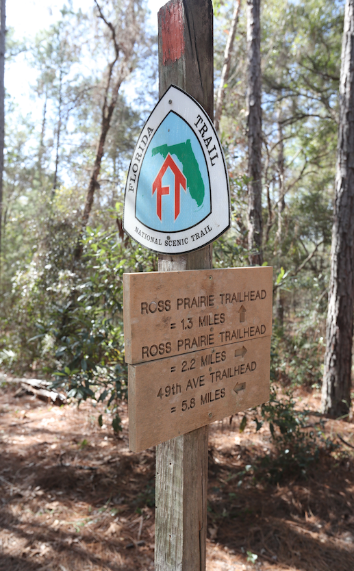
A Florida Trail sign is shown on the Marjorie Harris Carr Cross Florida Greenway Ross Prairie Trail, which is part of the Florida Trail, off State Road 200 west of Ocala, Fla. on Tuesday, Feb. 1. One of the proposed Northern Turnpike Extensions comes right through the Ross Prairie Trail and the Ross Prairie Forest. [Bruce Ackerman/Ocala Gazette]
Water Resources – Degree of Effect – (4) Substantial
Similar to their position on the effects of the Alternative Corridor Central, Somerville believed the proposed route will adversely affect water resources in the area because it “Is a new roadway alignment through primarily undeveloped land and extended length.”
Further, she noted the “EPA is concerned about the potential impacts to marsh and spring systems, the potential for extensive effects to Outstanding Florida Waters (OFW), and the potential impacts to federally managed fish species and their prey within these OFW. As a result of the proposed alternative’s extended length and significant and broad effects, the EPA does not recommend this alternative.”
Protected Species and Habitat – Degree of Effect – (3) Moderate
FTE’s report stated the Alternative Corridor Central contains various wildlife habitats, and that the Florida Fish and Wildlife Conservation Commission (FWC) compared the alternative corridors by the various Critical Lands and Waters Identification Project (CLIP) priorities and the FWC Habitat data.
Once all the proposed routes were analyzed, the report noted the “Aggregated CLIP priorities found Alternative Corridor Central has the second highest percentage of Priority 1 lands (25.78%, 10,884 acres) compared to other alternative corridors. FWC Integrated Wildlife Habitat Results ranked Alternative Corridor Central as having the second most habitat of all alternative corridors (32.66% Moderately High, 14,733 acre). Alternative Corridor Central is within the USFWS Consultation Area for the Florida scrub-jay, red-cockaded woodpecker, and snail kite. It is also within a Florida scrub-jay service area and Florida black bear range.”
Although it also found no critical habitats were present in the route’s proposed area.
Zakia Williams with the US Fish & Wildlife Service observed “Species of concern in the area are the FL scrub-jay, sand skink, wood stork, and the eastern indigo snake.”
Mark Kiser with the Florida Department of Agriculture and Consumer Services (FLDACS) noted that “Two gopher tortoise relocation permit recipient sites are within the 1 mile buffer. Documented Threatened & Endangered plant species include giant orchid, 0.1 acres (1 mile buffer); longleaf fingergrass, 31 acres (100 foot buffer); longspurred mint, 5.5 acres (100 foot buffer); and plume polypody, 0.9 acres (1 mile buffer). There are 24 managed areas that may have impacts to prescribed burning operations.”
Additionally, the report mentioned “Main direct impacts for both state forests on prescribed fire operations/smoke management on state forest property, and fragmentation effects for animals with large home ranges,” as a potential issue with the proposed route.
David A. Rydene with the National Marine Fisheries Service (NMFS) believed the proposed route will not impact any NMFS resources directly.
He noted, however, that not just the Alternative Corridor Central, but all of the proposed routes “Will cross numerous marsh and spring systems (e.g., Gum Swamp), and in some cases also cross the Withlacoochee River as well.”
This is worth noting, Rydene believed, because, “The mouth of the Withlacoochee River, Withlacoochee Bay, and the Gulf of Mexico contain habitats (e.g., salt marsh and seagrass) used by federally-managed fish species and their prey. Construction and use of the Northern Turnpike Extension could result in an increase in the amount of sediment, oil and grease, and other pollutants reaching estuarine and marine habitats utilized by marine fishery resources.”
Air Quality – Degree of Effect – (2) Minimal
Regarding air quality, Somerville did not see a substantial drop in potential air quality once the road was operational, however, she stated “The proposed roadway improvement and expansion may temporarily degrade air quality during construction.”
Contamination – Degree of Effect – (4) Substantial
FTE found that “Within the Alternative Corridor Central, there are 23 storage tank contamination monitoring sites, seven petroleum contamination monitoring sites, 12 hazardous waste facilities, 13 Resource Conservation and Recovery Act (RCRA) regulated facilities, and five solid waste facilities. Due to the number of contamination-related features within the area, and the potential for impacts to the alternative corridor areas from existing sources of sub-surface contamination to occur.”
Further, Ritter noted regarding the Florida Aquifer Vulnerability Assessment II of the Floridan Aquifer System that the area was classified as “Most Vulnerable” for approximately 100% of the project area within a 500-foot buffer.
Support community journalism
The first goal of the Ocala Gazette is to deliver trustworthy local journalism so corruption, misinformation and abuse are not hidden from the public or unchallenged.